Greg Picard's Final Project
A comparison of maps of Europe from England and France during the Napoleonic Wars
Patteson's Map of Europe
This is a map of Europe created in 1804 by Englishman Edward Patteson. It was created as part of an Atlas that depicted both Ancient and Modern Europe. So on this map, modern borders between nations are depicted, but Patteson accompanies many land…
Delamarche's Map of Europe
Here is a map created in Paris in 1800 by cartographer Charles Francois Delemarche. It was created for an educational atlas for children, and this map appears to be a political map of Europe. Focussing on France, Delamarche shows the boundary of…
Emmanuel-Auguste-Dieudonne's Map of Charles XII's Campaigns
This is a map created for a French historical Atlas depicting the war campaigns of Charles XII of Sweden. The map was created in roughly 1805 and it depicts a war in the late seventeenth century. Unlike the other maps, this map depicts an earlier…
John Cary's 1804 Map of the Netherlands
John Cary was a well known, well respected, and well-trusted cartographer in Britain in the later 18th century and early 19th century. In this map which he produced in 1804, he produces an extremely detailed map of the Netherlands and Northern…
Arrowsmith & Lewis's Map of the Netherlands, 1804
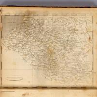
Here is an American map of the Netherlands created in 1804. Like Cary's map, this map seems to show the region of Belgium as separate from France. However, unlike Cary's map, there are no strict borders between France and Holland defined. Instead…
Herrison's Map of France, 1804
Created in the same year as many of the other maps in the exhibition, this map is a map of France, and includes the region of modern day Belgium unified as one country with the rest of France. This map, unsurprisingly, was created by a French…


