Browse Items (6 total)
- Tags: pictorial map
Sort by:
TheoS
This British cartoon map of Europe paints a belligerently nationalistic view of diplomatic relations in 1900. John Bull, Britain personified, is swatting away two cats -- Boer troops resisting British rule in South Africa -- while the rest of Europe…
Tags: 1900, 1900s, Britain, caricature, cartoon, nationalism, pictorial map, stereotypes
MiraH
This 1934 pictorial map was created by the Kellogg Company. The titular "Gifts of Nature" refers to agricultural plenty, but the map also depicts historical sites, industry, and Native American tribes. Also shown are railroad lines, migration routes,…
MiraH
This pictorial map depicts the history of the United States, with history seeming to be defined as colonial activity -- or even more broadly, white history (although it does record the historical locations of several Native American tribes). It…
Tags: Bodies of Water, Christopher Columbus, colonial power, Colonization, color, compass rose, covered wagons, Declaration of Independence, discovery, Europe, Gettysburg Address, historic sites, history, invention, manifest destiny, migration, monuments, mountain ranges, native americans, pictorial map, pioneers, progress, Railroads, seals, ships, travel, United States
MiraH
A 1930 pictorial map of the United States with a focus on the foods produced by each state. The colors of the map are vibrant, and the decoration stylized. Within each state, the artist/cartographer has drawn in imagery of the food products.…
ClaireC
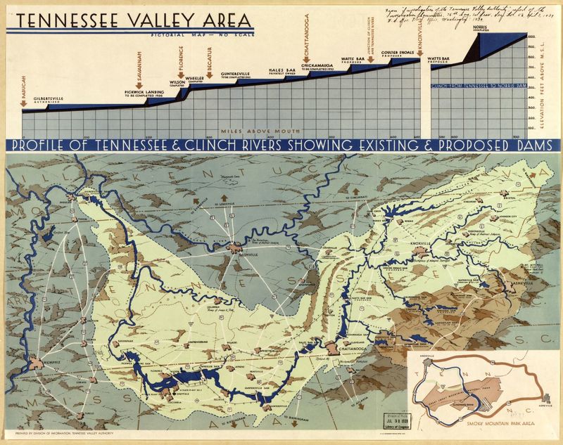
This pictorial map, produced by the Tennessee Valley Authority, shows the Tennessee River Valley region with particular emphasis on the proposed work and improvements of the TVA. As the map notes, there is "no scale," nor does it include a compass…
ClaireC
This map produced by the North Carolina State Advertising Division illustrates the recreational opportunities of Western North Carolina. The Great Smoky Mountains and Blue Ridge Mountains form the geographic boundaries of the region; there are no…


