This interactive map is a simple prototype of one possible digital history project: The Chinese Qing Empire (1644-1911)'s acquirement and organization of geographical knowledge in its northwestern border.
After the Qing empire conquered Xinjiang (The New Domination) in the northwest, the Qianlong emperor (r. 1735-1795) implemented some plans to acquire geographic information in the new territory. (Millward 1999) This interactive map will focus on two of these works: (1) making a surveyed map with graticule; (2) compiling a gazetteer. With the help of Jesuit missionaries, the surveyed map (Terrestrial Map of the Imperial Repository of Qianlong) was finished in 1761. One year after, the first edition of the gazetteer (The Gazetteer of the Western Regions ) was also completed. The expanded edition of the gazetteer was finished in 1782.
Gazetteer as a genre has a long history in Chinese Historiography, and it was usually considered by Chinese literati as one of the main sources of geographic knowledge. The surveyed map, on the other hand, was a genre unfamiliar to Chinese literati. Comparing the two genres may shed light on the different ways of structuring geographic knowledge. Furthermore, it may offer hints to how new geographic knowledge could be assimilated into traditional framework.
As a prototype, this map uses only a small portion of the Terrestrial Map of the Imperial Repository of Qianlong (near modern day Ürümqi). The first edition of the gazetteer could hardly be found today, the edition used here is a copy of the 1782 expanded edition digitalized by Harvard University Library. (The map will be abbreviated as the Qianlong Map in this project.)
1. Organization of Information
The map and the gazetteer organize information in quite different frameworks. The Qianlong map is composed of 104 copper plates. The vertical words at the left side of the map show its location in the whole map: "Row 8 West 3."; The division of the 104 maps does not follow the administrative units, and the boundaries of different administrative units are not depicted.
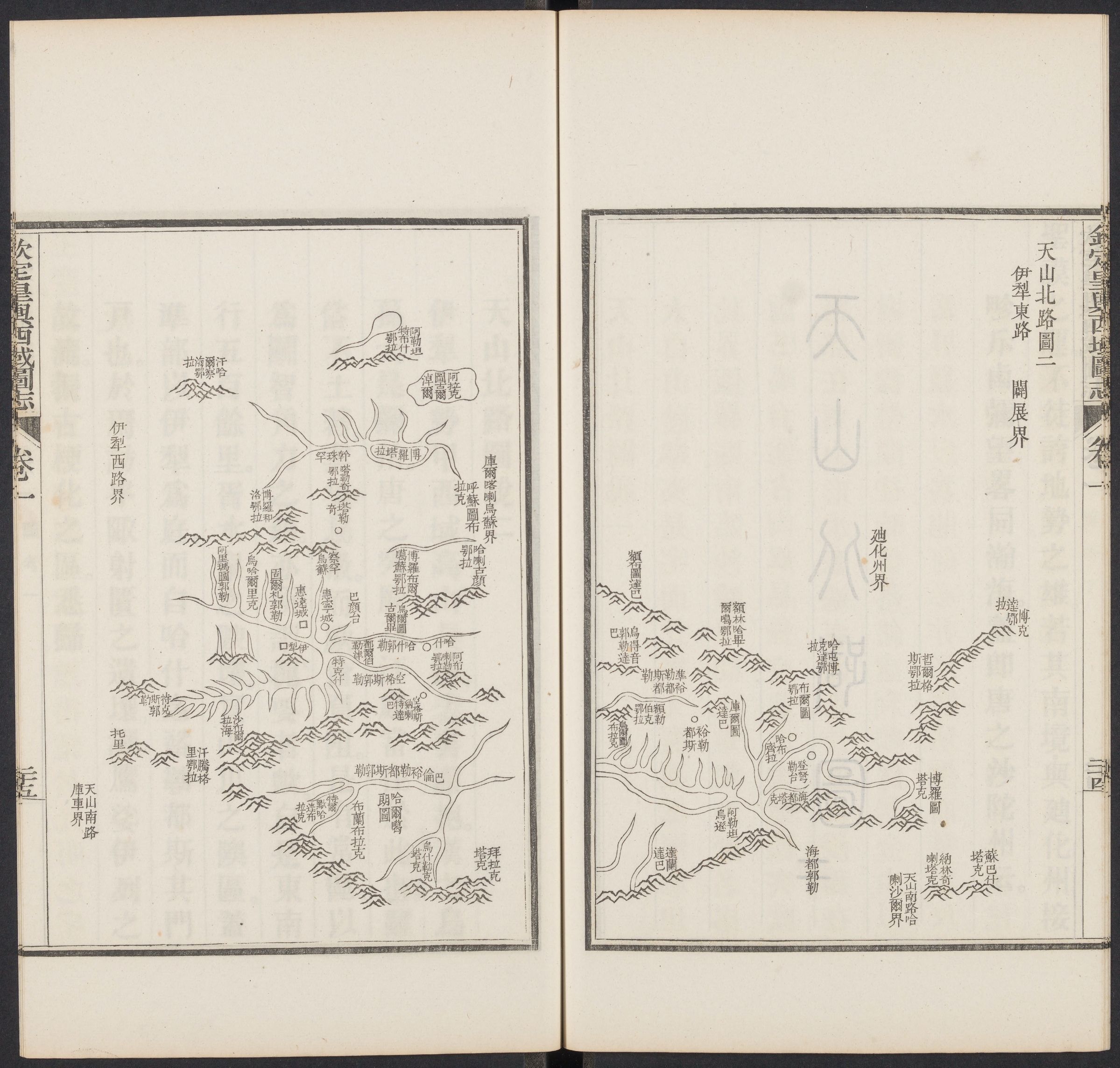
The gazetteer is a more complex genre. Although the main content of the gazetteer is texts, it also includes different kinds of maps. Three points should be noticed:
(1) In contrast with the surveyed map, administrative units are one crucial element in the gazetteer. Most of the information are organized under different units. Each administrative unit has a map in accompany with it. Nevertheless, these maps do not have graticule. (Example)
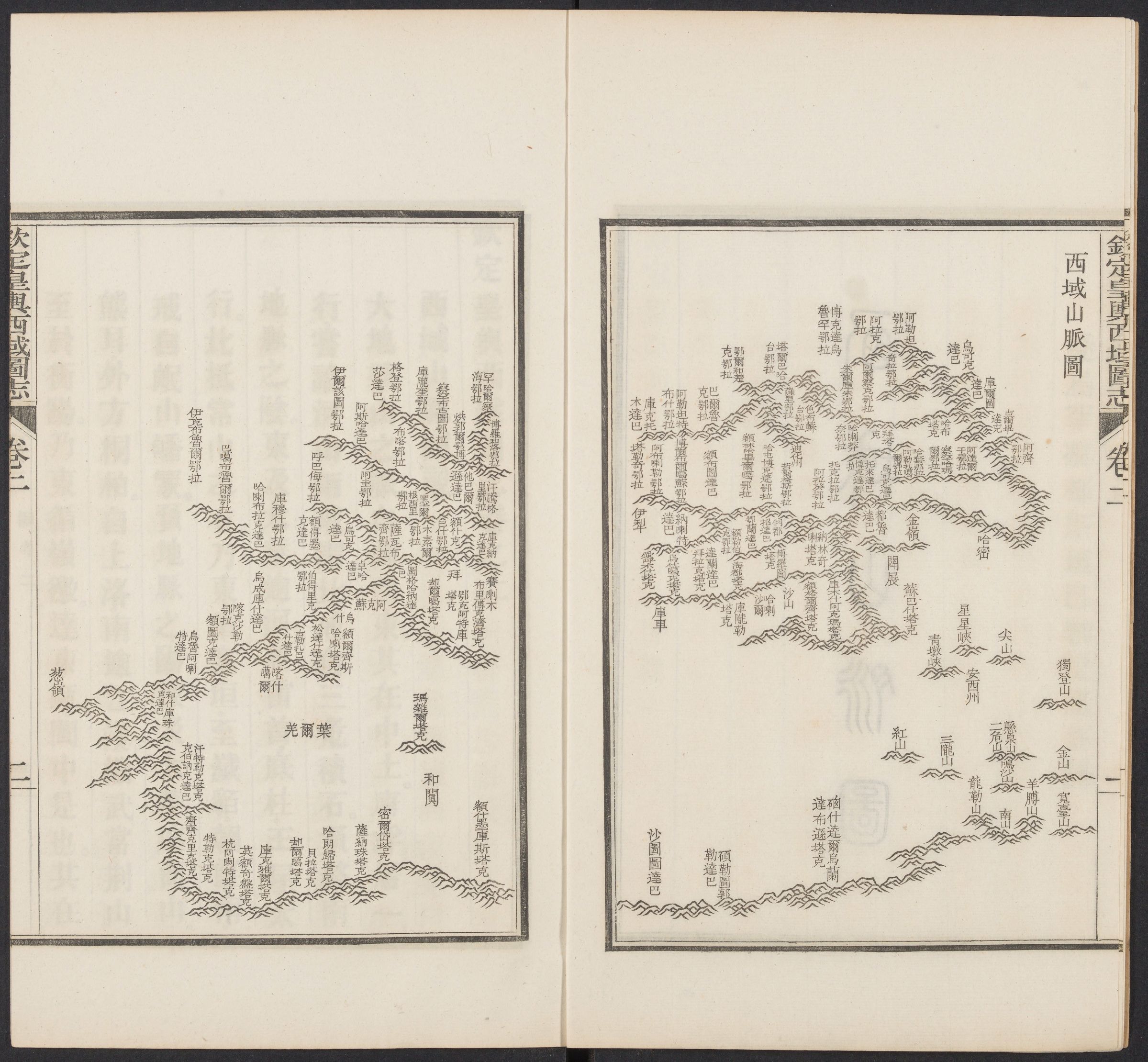
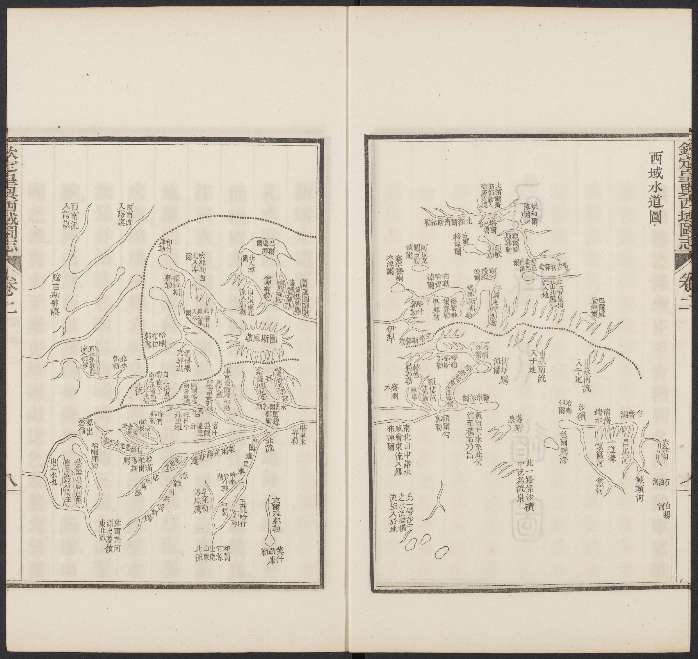
(2) The surveyed maps combine waterways, mountains, towns, roads altogether. It is interesting to find that the gazetteer contains thematic maps, such as the depiction of all the mountains or rivers in the Western Region. It should be noticed that the editors tried to embed cultural meanings into these landscapes.
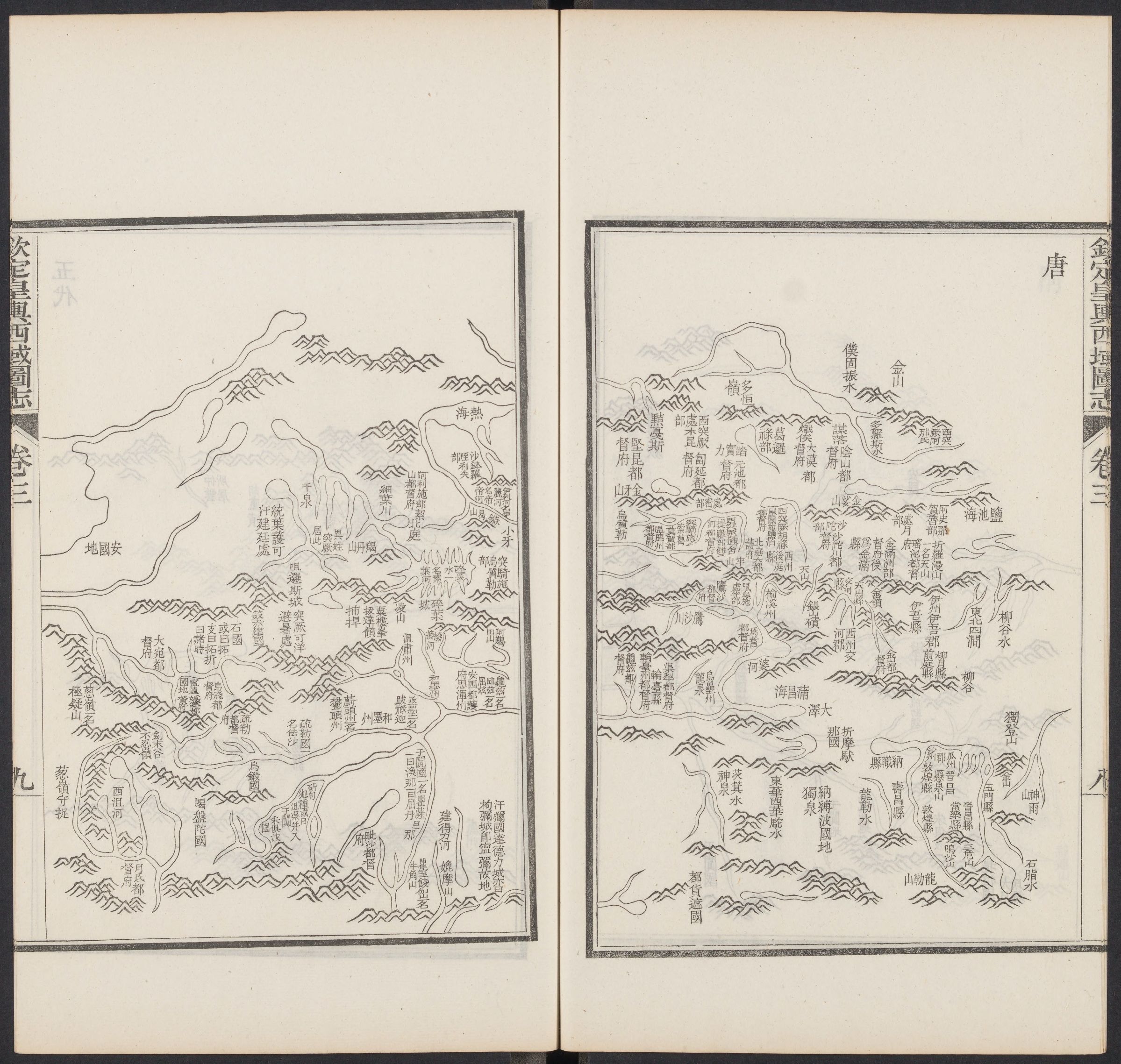
(3) The surveyed map preserved the place names (selectively) at the time of the survey. But for the editors of the gazetteer, they want to add historical dimensions. One way is to make tables showing the old names of one place in different phases. Another way is to make maps of the Western Region in different Dynasties. (Example: in the Tang Dynasty (618-907 C.E.))
2. Multiple Purposes in a Geographic Work
Map and gazetteer are all multi-purpose cultural texts. It would be interesting to investigate the motives of cartographers and editors to present specific information in their works. Here I want to discuss one special purpose: to please the emperor.
How to please the emperor with the surveyed map? On the surveyed map, the cartographers decided to emphasize the landscapes which were related to Qianlong. For example, three items on the map were illustrated with particularly large scale: two stelae erected by Qianlong and one Tibetan Buddhist temple restored by him. In compiling a gazetteer, the editors had more possibilities to please the emperor. For instance, they collected many poems and articles composed by Qianlong in the gazetteer.
3. About Place Names
From the 1761 map to the 1782 expanded edition of the gazetteer, the Chinese translation of place names has changed a lot. It is possible that the compilation of Unified-language Gazetteer of the Western Regions based on the gazetteer standardized most of the place names. However, this could cause inconvenience to the usage the surveyed map. The translated names on the map became outdated, and it would be difficult to revise all of them on the copper plates.