Browse Items (17 total)
- Tags: rivers
Sort by:
ClaireC
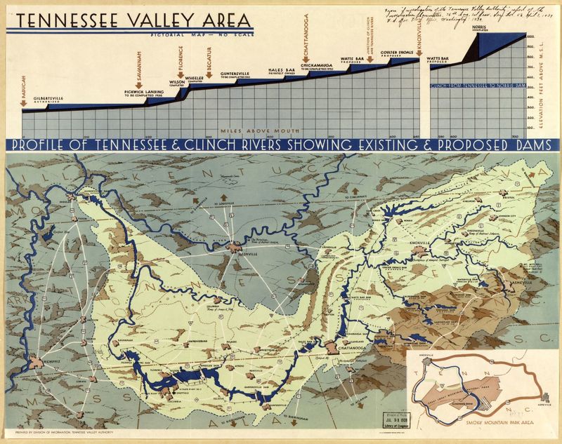
This pictorial map, produced by the Tennessee Valley Authority, shows the Tennessee River Valley region with particular emphasis on the proposed work and improvements of the TVA. As the map notes, there is "no scale," nor does it include a compass…
JoseR
Containing water elements such as rivers, lakes and coastlines, this layer is important because it represents en element of transporting of goods, travel, and resources. As a Dutch copy, this map could have provided information on access points for…
Tags: lakes, resourses, rivers, transportation network, water bodies
ClaireC
This layer traces all of the rivers included on the map. I have tried to recreate the variations in line thickness used on the map to indicate relative size of the rivers. Not included in the layer are the names given to the rivers or the explicit…
Tags: current direction, navigable, retraceable, rivers, watershed
IsabellaC
In his map, Vespucci does not distinguish between countries or within land masses by lines. Instead, the lines on the map show the enge of land and how it borders with water, primarily oceans and seas. I have also included rivers in this layer…
LucieR
This layer contains the contours of the land that is pictured on the map. Naturally, those contours delineate the water spaces on the map as well. This layer is important because I think it is the base layer for the rest of the features of the map.…
Tags: Colonization, lakes, Land, rivers, sea, the New World
AbigailP
This layer shows the rivers shown in North America and Asia, as well as lakes (shaded in) to which inland rivers connect. Rivers (and their labels, which I have not included in this layer) make up the majority of information shown in continental…
JoseR
1 map : hand col. ; 47 x 55 cm. - Relief shown pictorially. "Cum privil. ordin. general. Belgii Foederati." Fourth state, according to Burden. Appears in author's Atlas minor sive geographia compendiosa. Includes decorative cartouche and inset view:…
Tags: animals, bear, Belgian lion, buildings, cartouche, colony, color, deer, depth, dutch, fauna, fortifications, forts, fur trade, green, hand colored, hatching, hills, hudson river valley, latin, line weights, manhattan, mountains, native americans, new amsterdam, new england, perspective, perspective lines, rabbits, red, resources, rivers, settlements, shading, text, trees, tribe names, turkey, waterfront, yellow
JosiahC
This map provides a loose sketch of the Little Missouri River Basin, with a focus on the tributary streams that flow into the Little Missouri, and the ranches in the area. Ambiguity about the map's authorship, date of creation, and scale--not to…
ClaireC
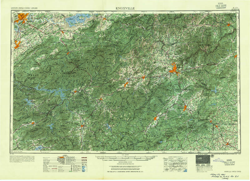
This large-scale topographic map covers the region between Knoxville, TN and Asheville, NC. As an official U.S.G.S., the map makes claims to objectively representing the landscape through topography. The consistency of representation across such a…


